A Warm December ends With a Cold New Year’s Eve

December 30, 2018

5pm Sunday…

We had a nice cold front pass through the region Saturday evening, leaving us with scattered showers and sunbreaks today.    Tonight skies begin to clear out as we get into a cool northeast flow for a couple days.  This isn’t an “east wind comes blasting in with bitter cold temps” sort of setup.  It’s just back to normal temps or even a little below (especially at night) for most of us.  That’s something we haven’t seen much of the past 2-3 weeks.  Since early October we’ve been in a mild/warm weather pattern much of the time.  This December will likely end up in the top 10 warmest at PDX.  As of the 29th, it’s the warmest since 1979, but that will change with cooler temps this evening and Monday.

Month Climate Temps Calendar

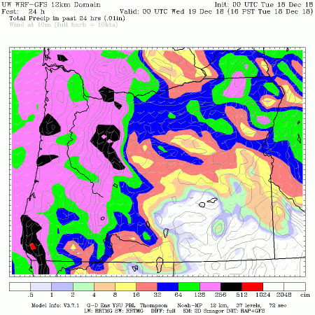
We have caught up on rain, making it just about average for December.  Snowpack has been slowly improving the past week as well.  Now over 50% throughout Oregon with much of Eastern Oregon right at average.  Very nice! Considering I can hardly see movement on Hwy 26 @ Timberline Road on the ODOT camera at 5pm, I’m guessing that a LOT of you are enjoying the snow?

or_swepctnormal_update

One thing we’ve been missing?  Those of us in the east wind areas missed the cold nights in early December, meaning some parts of Portland central/east metro have barely seen a frost!  PDX has hit 32 four different times, and will likely do it either tomorrow morning or by midnight tomorrow night once again

Mark Warm Low Temps

That’s quite unusual, even for that relatively urbanized location at the airport.  All the rest of us in the western valleys have been down into at least the mid-upper 20s.

Mark Warm Low Temps2

You can see that most Decembers we get at least down into the mid-upper 20s at some point at PDX

December Coldest Night Each Year


We are 1/2 of the way through our “storm & cold” season and I think it’s fair to say it’s been a real dud so far.  It shouldn’t be a surprise in this El Nino winter; these are sometimes quite boring for the geeks like me.  Yes, I know it’s not officially an El Nino, but most likely it will be considered one once we look back on it.  It’s especially disappointing considering it’s our second consecutive cool season (so far) with not much exciting weather.  You may recall that last year was a real dud from November through mid-February, except for that Christmas ice/snow.

What’s ahead?

It’s very clear that we’re back into a ridgy/split-flow pattern for the next 7-10 days.  Little or no storminess, just occasional wet weather systems.  Temperatures will likely be milder than normal for at least the first week of January.  The 18z GFS shows 3 systems splitting as they move towards the coastline: this Friday, Wednesday the 9th, and Friday the 11th.

This slideshow requires JavaScript.

The ECMWF model is a little more consolidated the next 10 days, but still “weak” looking.

SUMMARY

  • THERE IS NO INDICATION THAT WE’LL SEE ANY LOWLAND SNOW/ICE IN THE NEXT 10 DAYS
  • NEW YEARS EVE WILL BE CHILLY AND CLEAR AT MIDNIGHT; POSSIBLY A FEW SPOTS OF FOG DEVELOPING LATER
  • NEXT CHANCE FOR RAIN IS THURSDAY

Chief Meteorologist Mark Nelsen


Those 12 Days of Christmas? Looking Quiet Weather-Wise

December 26, 2018

7pm Wednesday…

Merry Christmas to all!  Hope you had a great holiday and enjoy this fun Christmas Week leading up to the New Year.

I’m confident the weather won’t be affecting your plans much.

Why?

Because after some briefly exciting weather mid-month things are back to “slow” once again which has been the story since early November.  Mild too.  This December is running 8th warmest of the past 75+ years at PDX.

Here’s what I see as we head through these 12 days of Christmas (through Friday the 4th):

  • No sign of arctic cold or low-elevation snow
  • No sign of freezing rain in the metro area
  • No big storms with high winds or flooding

We have just ONE organized warm/cold frontal system coming through Saturday through early Sunday.  Even that one isn’t very impressive, but will give us a nice shot of Saturday night rain and mountain snow.   There are hints another organized system could come through about a week from tomorrow too.

Note the ECMWF meteogram shows nothing interesting temp-wise (unusually warm OR cold) the next 15 days.  This is the average of all 51 ensemble members:

KPDX_2018122612_eps_min_max_15

Far more interesting from a meteorological standpoint is that NONE of those ensemble members show snow in Portland during the next two weeks.  The point here is that we seem to be in weak upper-level ridging and/or a splitty/weak jet stream for the next 10-15 days.  On any typical winter day I’ll see at least a few of those horizontal lines showing some snow at some point during the next two weeks.  That shows there is good agreement on an average to above-average temperature regime to start January.

KPDX_2018122612_eps24_snow_360

That said I don’t see a dry east wind setup to give us significant sunshine until next Monday; we’ll be seeing plenty of gray tomorrow through the weekend.

This IS turning out to be a typical weak/moderate El Nino cool season in our area…a bit drier and warmer than average.

Chief Meteorologist Mark Nelsen


Cascade Snowstorm Plus Dry Christmas Ahead

December 23, 2018

6:30pm Sunday…

It’s Christmas Eve “Eve” in the weather center, all the bosses are gone and it’s crazy in here!  Actually it’s real quiet in here.  The radar is lit up though…downpours moving through the western valleys of SW Washington and NW Oregon

KPTV 2017 Default Earth

It’s an upper-level “trough” or wiggle in the jet stream passing by bringing the showers.   Those showers die down tonight.  Check out the snow storm on Mt. Hood.  As of 6pm we’re approaching a foot and a half of snow above Government Camp.  It’s nice to finally see a good snowstorm up there.

Snow Mt Hood Totals

As of this morning you could see how far behind we are on snowpack; pretty bad (but it’s early!) in the Cascades.  Frustrating for ski resorts trying to get more terrain open.  Obviously this storm is doing the trick!  As of now Meadows and Timberline are over the 50″ deep mark, excellent for skiing/boarding, and the top of Skibowl is up to 24″.  They should be able to totally open up Wednesday I think.

or_swepctnormal_update

WHAT’S AHEAD?

Headlines December Christmas 2

Tomorrow a wet (white in mountains) system travels across southern Oregon which leaves the extreme northern part of the state dry.  The 10am RPM model shows the setup well:

RPM Clouds Rain Snow

North of a Newport to Pendleton line it’s unlikely you’ll see anything other than a few sprinkles for Monday.  Then skies go clear or partly cloudy for Christmas Eve itself (tomorrow evening).  It may be a frosty/chilly Christmas morning for many of us west of the Cascades.  Then we have a DRY AND PARTLY CLOUDY CHRISTMAS.  Pretty nice I think.

I’m watching Wednesday morning closely because we have a setup where we don’t get much southerly breezy, a residual low-level cool atmosphere, plus an incoming front right at sunrise.  This can give brief rain/snow mix to lower elevations or even all snow briefly to spots like the hills of northern Washington/Clark counties, Vernonia, or Columbia County.  There could be some brief “whitening” in those spots, but nothing that would affect your Wednesday AM commute unless you are up around 1,000′ elevation.

Beyond that time the weather pattern through the end of 2018 features a couple weak systems coming over the top of an upper-level ridge developing over the Eastern Pacific.  Looks like that one Wednesday then another Saturday/Sunday.  Then models want to push the ridging almost right over us around the New Year and beyond for a quiet start to 2019.  That’s still 9 days out, but pretty decent agreement on that upper-level ridging January 1st from the GEM, GFS, & ECMWF ensemble systems

This slideshow requires JavaScript.

At least we did have some weather fun for almost two weeks

  • Brief Gorge ice/snow
  • Two coastal wind storms and two valley wind “events”
  • Some good mountain snow

But now it looks like slower weather for at least the next 10 days like we have seen earlier in the cool season.

Merry Christmas!

Chief Meteorologist Mark Nelsen


Storm Recap; A Windy Night & Nice Soaking

December 18, 2018

8pm Tuesday…

Last night’s forecast turned out well.  When we look back at this event it’ll just be a typical winter storm.  But it sure was nice to see after such a slow start to the storm season wasn’t it?

RAIN

Quite a soaking.  Most spots in the metro area saw 1″ or more, some spots more than 2″!  PDX saw about 1.30″ since the rain started yesterday afternoon.  There was no intense band of rain for the morning commute so we avoided any sort of widespread road flooding.  This is the type of rain we need to soak in for the next dry season.  Note we’re just about back to normal for December now.

web_PDXRain_10days

WIND

I’m glad I made a last minute downward adjustment to the wind speed forecast.  All the airport locations remained below 50 mph.  Quite a few spots saw nothing more than a typical breezy night (Scappoose, Vancouver, Troutdale, Gresham etc…)

Dec18WindValley

Way up on the Fremont Bridge there was a gust to 50 mph, and a tower on top of Chehalem Mtn near Newberg hit 59 mph.

Of course it was a real wind storm at the coastline.  Cape Foulweather made it to 90 mph, and most coastal cities were in the 55-70 mph range

Dec 18WindCoast

Today was pretty quiet in our viewing area and amazingly warm with midday sunshine.  We hit a record high in Portland…59 degrees!  There were some downpours this afternoon and even a few lightning strikes with a few showers though.

Todays Observed Highs OrWa 2017

Tomorrow will be uneventful, then a powerful storm moves towards British Columbia tomorrow night.  This system will have a weaker wind field.  That keeps most effects on the coastline; not a significant wind producer for the valley.

Chief Meteorologist Mark Nelsen


9pm Update: A Few Tweaks To Forecast

December 17, 2018

All the evening weather models are in except the ECMWF.  If you didn’t read my midday post read that first.

The biggest change I see is the front moving across our area more quickly tonight.  That means:

  1. Forecast rain isn’t quite as heavy = maybe only a few scattered spots of roadway flooding if we get lucky!
  2. Gusty southerly wind in the valleys is a bit lighter and moves south of us more quickly.  I changed the forecast to 35-45 mph gusts in the valley.  North of the Columbia River (Clark County) I doubt it’ll gust much over 30.

Peak wind still appears to be around 1-4am in the metro area and valleys, but again, THIS ISN’T GOING TO BE A BIG WINDSTORM.  Just a few power outages here and there.

Warnings Wind Coast Valleys2

Here’s the 1am RPM wind gust forecast:

RPM_1am

Notice the RPM model has all the gusty wind south of Salem by the time we get to the morning commute; looks pretty quiet in the Portland metro area.

RPM_5am

And here’s the WRF-GFS with its lighter rainfall forecast.  A bit over an inch in the western valleys.

wrf_24hrain

Chief Meteorologist Mark Nelsen


Stormy Late Tonight & Messy Tuesday AM Commute

December 17, 2018

11:30am…

Just a quick update to let you know we’re still expecting a nice little wind/rain storm overnight and into Tuesday morning.  I just checked morning models/maps and everything still looks the same.

Gusty wind develops this evening in the valleys and continue through the night.  Plus moderate to heavy rain will likely fall right during the Tuesday morning commute from Kelso to Salem.  Bad timing.

KEY POINTS

  1. Light rain arrives late this afternoon and continues through the night, turning heavy around 4-8am in the Portland metro area.  We could see .20-.30″ hourly totals for a few hours.  For comparison, that MAX flooding situation in October 2015 we saw several hours of .20″ then a sudden .50″ in one hour.  We could see some local flooding of roads/underpasses during the heaviest rainfall.
  2. A breezy southerly wind develops around and beyond sunset.  Gusts 30-40 mph are possible anytime during the night, then wind should be strongest sometime between 1am-7am.  I expect gusts 40-50 mph in the western valleys from Vancouver to Eugene.  This is similar to what we saw on Friday and we’ll definitely get some power outages. Maybe not as strong up at Kelso though.  Coastal gusts will be in the 50-65 mph range; of course the higher exposed spots will be stronger.
  3. Wind will die off quickly after 7am, then rain turns to showers by midday.


Check out the WRF-GFS meteogram, you see the 30 kt sustained wind over Portland around 4am, plus the hourly .30″ or so total around 7am (bottom graph).

kpdx.mg

ECMWF gives us about 1.5″ rain from now to Tuesday afternoon.  This isn’t typically a big issue, the problem is that much of that will fall from 3am-10am.  It’s about rain intensity, not total quantity.

ecmwf_10am_totalprecip

And finally the WRF-GFS giving us .60″ in three hours ending at 7am.

oc_pcp3.27.0000

So again, as mentioned in yesterday evening’s post, this isn’t a “big storm”, but timing of rain/wind is bad for that Tuesday morning commute.

Chief Meteorologist Mark Nelsen


A Stormy Monday Night Ahead

December 16, 2018

7pm Sunday…

It’s almost Christmas, just 8 days away!  What does that have to do with stormy weather?  If you grew up here in the Pacific Northwest, then the upcoming week will finally look like Christmas seasons from the past…rainy & windy with mountain snow.

Six weeks into this “storm season” and it has been a real dud so far.  Very few storms and rain is running above 1/2 of normal since November 1st.  But we’re going to get another wind “event” Monday evening/night like we had this past Friday plus a real soaker Monday night.

A more typical strong westerly jet stream is developing for a few days and will be directly over us for the next 48 hours.  A system is developing out in the Eastern Pacific (you see it on the left side of this GOES-17 pic)

Capture

You can also see a long train of subtropical moisture embedded.  Models push all this moisture directly toward Oregon and it’s overhead tomorrow night, seen here on the “Integrated Water Vapor Transport” forecast

ivt.42.0000

That’s pretty juicy and models are showing a period of moderate-heavy rain tomorrow evening through Tuesday morning over and west of the Cascades.

RAIN

ECMWF gives us 1.5″ in the driest part of the lowland valleys to 3-6″ in the mountains Monday 4pm to Tuesday 4pm.

ecmwf_precip_24_portland_11

Both the RPM (The Weather Company’s model) and WRF-GFS from UW model are similar, although a bit wetter.  This is the latest RPM.  Notice 2″ or less in the valleys.  That’s not enough to cause widespread flooding after a dry start to the season.

RPM Precipitation Accumulation

This isn’t a “big flood” setup since the heavy rain spends less than 24 hours over us.  Yet rivers will rise quickly, a few creeks/streams may go over their banks, and Tuesday morning’s commute should be especially messy when the heaviest rain is moving through.  Expect some water on roads/highways in spots.  Only a few rivers should experience (minor) flooding.  The big rivers are fine since reservoirs are nearly empty after a dry fall and early winter.   The NWS has a Flood Watch out for our area for this reason.

Mark Warnings Flooding

WIND

We don’t have any strong area of low pressure to track with this storm, it’s just a relatively tight pressure gradient as the system comes through.  So no, I don’t see a big windstorm coming, but maybe speeds similar to what we saw on Friday inland.  That would be gusts 35-45 mph.  We’ll switch from east to southerly wind tomorrow afternoon and then it should be strongest along the I-5 corridor tomorrow night.

This slideshow requires JavaScript.

Once we get past Tuesday midday or so it’s relatively quiet again, just some typical east Pacific cold fronts passing by.

Most of the precipitation will be as heavy rain in the Cascades Monday night and Tuesday; we’re going to lose some snow up there!  A little bit more rain Thursday, but then there are strong hints we’ll see colder systems Friday through Christmas Week.  Hopefully that will get more terrain open as Christmas Break starts for lots of kids this weekend, others are already out of class.

Chief Meteorologist Mark Nelsen