8:30pm Friday…
I hope you enjoyed a bit of “Apr-uary” today. As predicted, a warm southerly wind plus most rain shifting north of us lead to some record high temps. PDX reached a record high of 62, tying for warmest of the month. Troutdale also broke a daily record

Three other cities tied record highs.
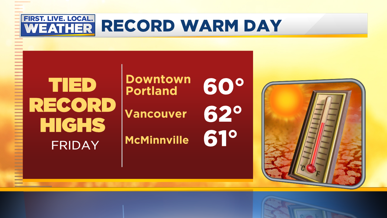
Salem, Eugene, Roseburg, & Pendleton made it to within one degree of their record highs.
This final push of warmth makes January 2020 the 2nd warmest on record in Portland; the warmest since 1953. Interesting that 4/5 warmest Januarys have been in the past 15 years isn’t it?

What’s ahead? A sharp cold front arrives early tomorrow morning with some steady rain. Then it’s on to light showers (more dry than wet) this weekend. Showers come to an end sometime after the Super Bowl ends Sunday evening. Most likely we’ll be dry from late Sunday evening through at least midday Tuesday.
During these next three days the snow level takes a big plunge. We use this graphic on-air to give our viewers a general idea of upcoming snow levels. This uses 850mb temps as a proxy for that snow level.

You can see the story. A big drop down to around 3,000′ tomorrow afternoon, then down around 1,500′ Sunday. A bit lower both Sunday morning and Sunday evening during the cooler parts of the day too.
Any of us may see snow/rain or even all snow showers Sunday afternoon. That’s why we’ve had “MIXED SHOWERS” in our forecast for Sunday…for at least 6 days. Some models are hinting at some brief heavy showers during the Super Bowl. If so, a quick dump of snow could come all the way down to sea level under one of those showers. I’ll be watching the radar closely Sunday afternoon! In general models are going for little/no accumulating snow at the lowest elevations during this period. The ECMWF

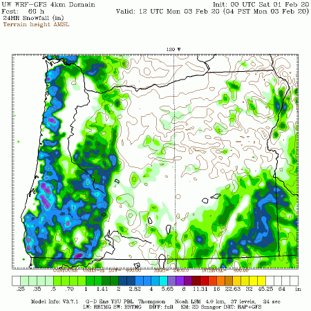
And the WRF-GFS (UW) 24 hour snowfall forecast Sunday morning to Monday morning
Let’s assume we get plenty of showers Sunday afternoon/evening. As skies clear Monday morning temperatures should drop. There’s a decent possibility we’ll see areas of icy roads for the Monday morning commute. Otherwise a cool and at least partly sunny day is on tap.
Beginning late Tuesday we enter another period of mild temps and rain that should last through the rest of next week. The ECMWF ensemble forecast high/low temps show the cool period Sunday-Tuesday, then close to normal or a bit below as we head into mid-February

Chief Meteorologist Mark Nelsen


 Posted by Mark Nelsen